Expect mild temperatures and a few passing showers today and Friday before cooler, fall air and plenty of sunshine move in for the weekend and next week.
A mixture of sun and clouds have moved across the Chattahoochee Valley on this Monday. While we have stayed dry for now, more rain coverage will be moving in, in the coming days.
We started off the month with a bit of an overcast date with a few sprinkles from time to time. Not everyone got in on the rain today, but more rain is headed to the Chattahoochee Valley in the coming week.
Dry weather returns to kick off the workweek. Monday brings partly cloudy skies with highs climbing into the upper 70s. Clouds will increase on Tuesday, though conditions remain dry for Election Day.
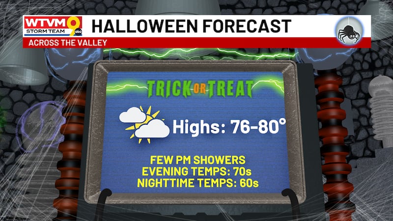
Not too spooky of a forecast when it comes to our Halloween! Some cloudy skies will persist, and while some of us will get a few isolated showers the further we move into the evening and overnight hours.
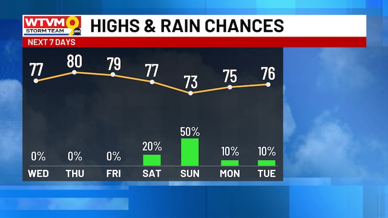
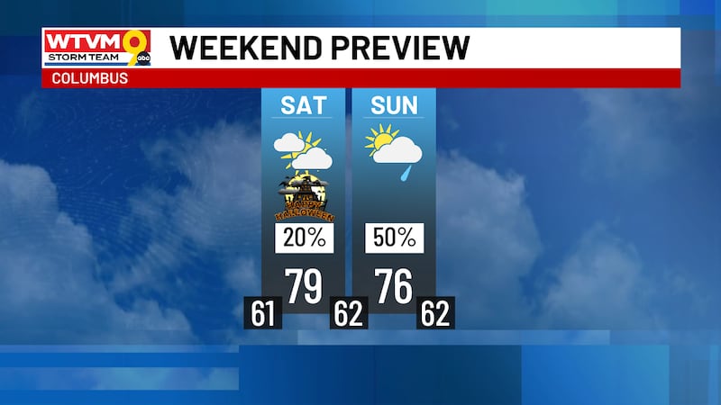
A comfortable Halloween is ahead with temperatures in the 70s, increasing clouds, and a few spotty showers possible around trick-or-treat time. More widespread rain arrives Sunday, with additional showers and storms possible midweek.
Keeping our skies clear, the ground dry, and the winds breezy for our Thursday. We will start to see those conditions change as we head into the weekend.
Keeping it dry as we have progressed through the week, and it will stay that way. As we head into the weekend, however, rain coverage will start to make an appearance for the first time in about two and a half weeks.
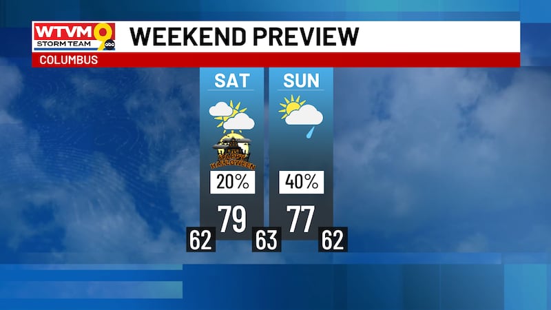
Saturday, Halloween, looks mostly cloudy with highs in the upper 70s and the chance for isolated rain late in the evening. The good news is most of the rain should hold off until Sunday.
Today’s highs will be staying in the low-to-mid 70s, keeping us at or below average for the day. One more day of this will persist until we see temperatures increase later in the week.
Expect a chilly start with sunshine and highs in the low 70s today & tomorrow. Dry weather continues all week with warming highs plus rain chances returning Halloween weekend.
Starting off the weekend with a beautiful, chilly morning, with a breeze moving through. We will continue to see these conditions as we finish off the weekend.
Sunny and dry weather brings a cool and crisp fall weekend with morning lows in the 40s. Expect a gradual warming trend next week with rain possible by Halloween weekend.
Chilly 40s mornings and warm 70s afternoons continue with sunshine through the weekend. Expect a light breeze Friday then gusty winds at times this weekend with no rain in sight.
Another chilly start in the 40s gives way to sunshine and highs in the 70s. This pattern of cool mornings and warm afternoons will continue with no rain in sight.
Started off our Tuesday with lows in the 30s and 40s across the Chattahoochee Valley. As we have continued into our afternoon, temperatures have been pushing into the mid-to-upper 70s.
A refreshing cold front moved through the Chattahoochee Valley overnight Friday. This led to a crisp Saturday morning, clear skies, and a breeze to start the weekend.
Gusty winds are ushering in much cooler air with morning lows in the 40s and 50s and highs in the upper 60s this weekend. Sunshine stays all week as afternoons warm back to the upper 70s.
Warm sunshine holds through Friday with highs in the mid and upper 80s, then a fall front brings cooler highs in the 60s and 70s and crisp mornings in the 40s and 50s this weekend.
Sunny skies, with few to no clouds to cool us down, warming us well above average. We will continue to see similar conditions to finish the rest of the week.
Tuesday started off with clear skies, and some patchy fog, bringing an amazing view of the SpaceX launch this morning. The cooler morning broke into a hot afternoon with highs pushing towards the 90s.
A beautiful start to the work week, with plenty of sunshine and a breeze. As we have continued into the afternoon, it has felt a little more like summer, highs pushing into the upper-80s.
With drier air moving in, rain will be hard to come by this week. The week will stay dry, with only a stray shower possible Friday. As conditions dry out, temperatures will warm.
Isaias is a post-tropical storm and is continuing to move it’s way out of the state of Alabama. Here in the Chattahoochee Valley, our pattern is going to change behind Isaias.
By Tyler Allender, Dana Barker, Madelyn Hess and Ashlyn Moore
The main threat has now passed as heavy rain and gusty winds have subsided. We are now watching for a very low-end severe weather threat for areas east of Columbus, but the majority of the WTVM area is in the clear.
We have issued an Alert Center Action Day for Saturday ahead of the local impacts we expect from Isaias. We are watching for gusty winds, heavy rain, and the possibility of an isolated tornado threat overnight Friday into Saturday.